Introduction
Location Map
Base Map
Database Schema
Conventions
GIS Analyses
Flowchart
GIS Concepts
Results
Conclusion
References
CONCLUSION
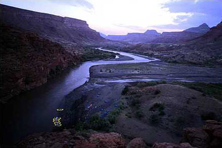
The purpose of our project was to come up with a qualitative annual erosion index for the Tekeze River watershed in Ethiopia. Using the Universal Soil Loss Equation (USLE) and GIS, we hoped to be able to map areas of high risk for erosion. Upon reviewing our resulting erosion index map, it is apparent that there are areas at severe risk for soil erosion. 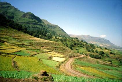 Many of these areas are along the river corridor and in the higher elevation headwaters. This can be of concern knowing that many people who inhabit the Tekeze River watershed are moving to the higher elevations and steeper slopes to cultivate crops. Meanwhile the river banks are open to livestock trampling and increasing erosion in many of these areas of severe erosion risk. It is obvious that the Tekeze River watershed is in a fragile state. If not properly looked after, soil erosion could lead to huge water issues for the Tekeze basin and the many people relying on its water downstream. That said, we do believe our results could be used, however, there are some aspects to the project that leave us hesitant to fully back the use of our maps.
Reviewing the resulting erosion index map, we feel there are too many uncertainties and possible errors to validate the results. The biggest reason we hesitate when viewing our erosion index is the fact that neither of us have set foot in Ethiopia, let alone the Tekeze River watershed. This fact by itself leaves us with many uncertainties to the accuracy of our data used in the analysis, along with the resulting erosion index calculated from these data.
Most of our data came from the internet without metadata. We have no idea of how old or outdated our data are. In a country where people are presently migrating to new areas, trying to implement agriculture or livestock, there is no certainty to when the landuse data were collected. This could have a huge impact on our results if the landuse data were not reasonably recent.  Besides landuse, the soils maps did not have percent soil type or organic matter, so we had to look up the soils separately and then attach what we can only guess is the right percent soil type values to the soils within the Tekeze River watershed. It is clear to us that the ambiguity of our data can only lead us to being insecure with our results.
Another area of concern was our resulting amounts of annual erosion for the watershed. These quantitative results seemed unreasonably high. The USLE is known for either substantially underestimating or overestimating annual erosion. Knowing this, our main concern of overestimating comes from the equations used to calculate each factor implemented in the USLE. Although these equations may have worked for previous research, this does not mean that the equations are suited for the topography or climate of the Tekeze River watershed. Again we can only assume that the equations are suitable for the Tekeze basin.
Although there are substantial reasons as to why our study may not be the most accurate, we believe that we have set a good framework for someone who is familiar with the Tekeze River watershed to be able to conduct their own soil erosion study. By following our steps and learning from our mistakes, we believe someone could use our project as a stepping stone to a more accurate evaluation of soil erosion within the Tekeze basin. One thing is certain, land practices within the watershed are becoming unsustainable and the Tekeze River Watershed could be in trouble if nothing is done.