Introduction
Location Map
Base Map
Database Schema
Conventions
GIS Analyses
Flowchart
GIS Concepts
Results
Conclusion
References
RESULTS
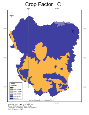
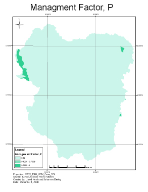
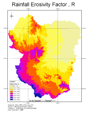
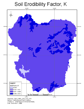
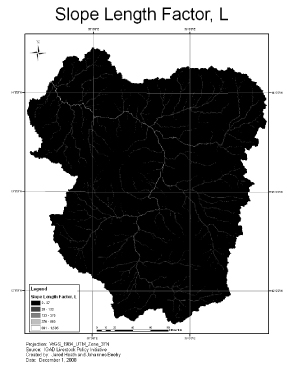
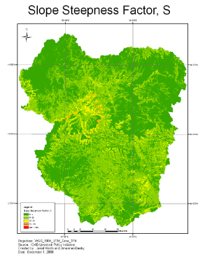
Universal Soil Loss Equation Factor Maps
The resulting factor maps below were created during the intial GIS analysis based on the Universal Soil Loss Equation. Each map was created by inserting the appropriate factor equation into the raster calculator. To see map in full click on desired map of choice.
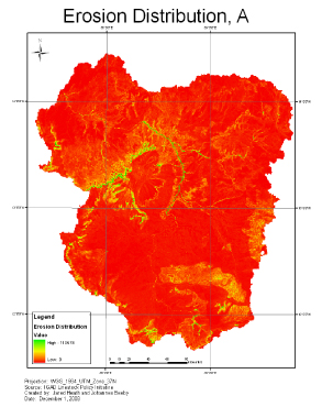
Resulting Erosion Distribution Map
The resulting erosion distribution map was created by overlay analysis. The analysis was performed with raster calculator following the Universal Soil Loss Equation, in which all factor rasters were multiplied together to create an erosion distribution for the Tekeze watershed. Click on map image to see map in full.
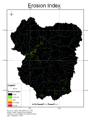
Resulting Erosion Index Map
The resulting erosion index map was created through reclassification of the erosion distribution map. This map allows for a qualitative analysis of the Tekeze watershed focusing on risk areas from slight to severe erosion. Click on map image to see map in full.