Introduction
Location Map
Base Map
Database Schema
Conventions
GIS Analyses
Flowchart
GIS Concepts
Results
Conclusion
References

Results
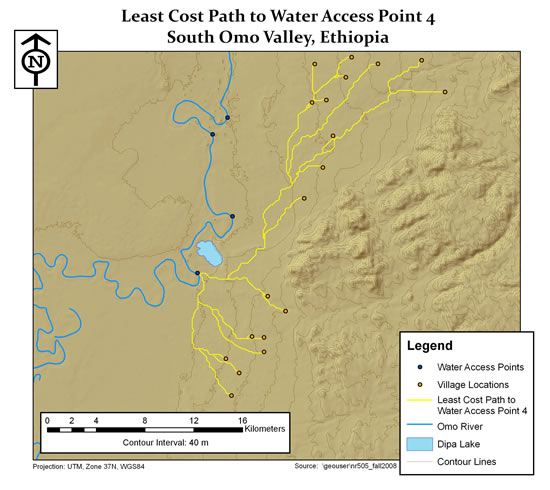
The first four maps show the outputs from our least-cost distance analysis for each of the four water access points. The water access points are numbered 1 to 4 from north to south along the Omo River. The networks shown in yellow are the end result of our analysis and indicate the least-cost path to travel from village locations to water access points.
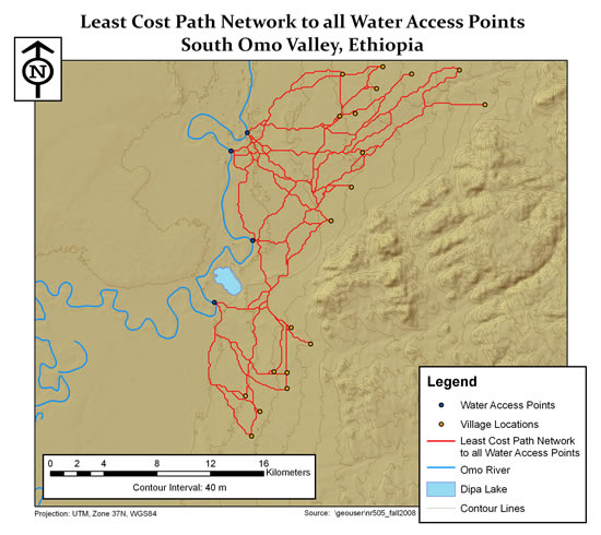
The last map is a composite of the four prior maps. The network shown in red indicates the network of least cost paths from all village locations to all water access points. Notice that many of the paths from the four previous maps overlap in portions on the composite map. If a trail network were to be designed from this analysis output there would be sections of trail that serve more than one village and/or more than one water source.