Introduction
Location Map
Base Maps
Database Schema
Conventions
GIS Analyses
Flowchart
GIS Concepts
Results
Conclusion
References
![]()
Base Maps
Ethiopia Base Maps
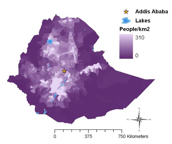
| Human Population Density (2005) |
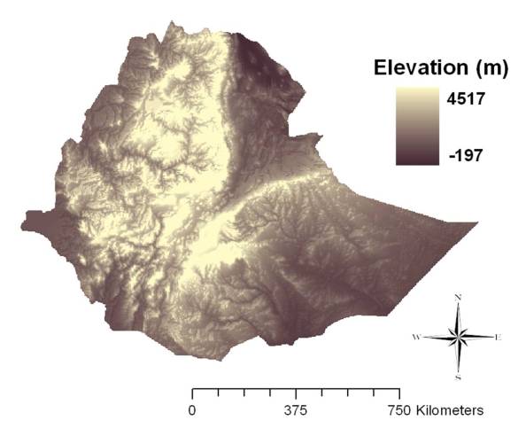
| Digital Elevation Map |
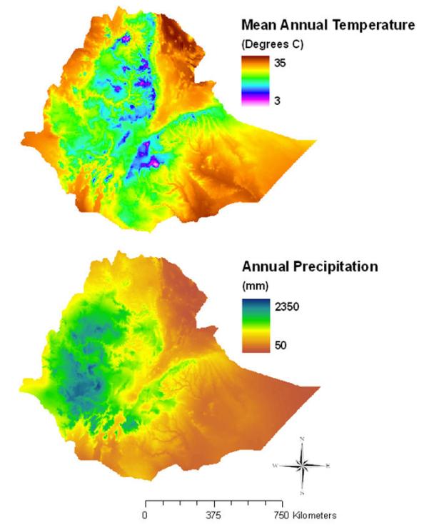
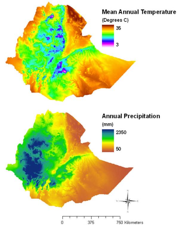
| Current Climate Conditions (1950 - 2000) |
| Future Climate Conditions (2020) |
| Future Climate Conditions (2050) |
| population |
Human Population Density (2005) |
 |
 |
 |
| Created by: Kelly Hopping and Greg Wann, November 23, 2009 Projection: WGS 1984 UTM Zone 37N Data Source: selected climate data from WorldClim, 30 arc-seconds (~1 km); all 19 Bioclim variable included in analyses http://www.worldclim.org/download |
| FutureClimate |
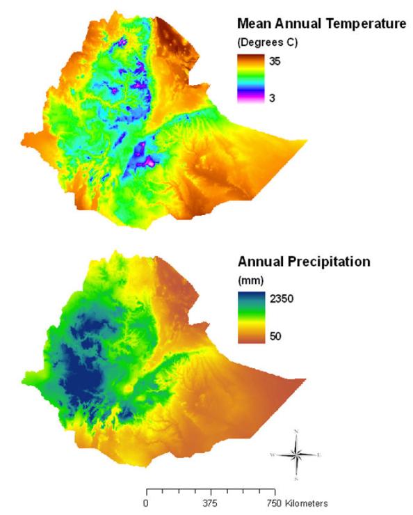
Future Climate Conditions (2020) |
 |
| Created by: Kelly Hopping and Greg Wann, November 23, 2009 Projection: WGS 1984 UTM Zone 37N Data Source: selected climate data from WorldClim HADCM3 model, 30 arc-seconds (~1 km); all 19 Bioclim variables included in analyses http://www.worldclim.org/download |
| FutureClimate |
Future Climate Conditions (2050) |
 |
| Created by: Kelly Hopping and Greg Wann, November 23, 2009 Projection: WGS 1984 UTM Zone 37N Data Source: selected climate data from WorldClim HADCM3 model, 30 arc-seconds (~1 km); all 19 Bioclim variables included in analyses http://www.worldclim.org/download |