Introduction
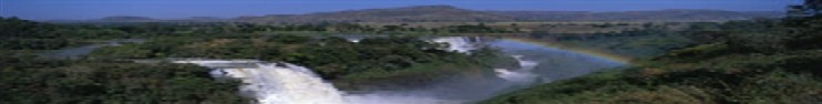
Location Map
Base Map
Database Schema
Conventions
GIS Analyses
Flowchart
GIS Concepts
Results
Conclusion
References
GIS ANALYSES
To create a soil erosion index for the Tekeze River watershed, we chose to implement the Universal Soil Loss Equation (USLE). USLE was created to predict long-term average annual erosion rates. Originally used for agricultural purposes, USLE has been turned to for predicting erosion rates for many other landuses. One flaw of USLE, is that it does not take into account erosion from gully, wind, or tillage practices, but only accounts for sheet and rill erosion occurrences on a slope. Despite this, USLE is considered to be widely-used and a potentially accurate predictor of long-term soil erosion.
USLE is made up of six factors of which each factor plays an important role in the soil erosion process. The equation and its factors are as follows:
A = RKSLCP
Where A = Average Annual Soil Loss in (Mg/ha)
R = Rainfall – Runoff erosive index factor(MJ mm/ha hr yr)
K = Soil Erodibility factor (ton ha hr/ha MJ mm)
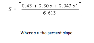
S = Slope steepness factor (dimensionless)
L = Slope length factor (dimensionless)
C = Crop-Management factor (dimensionless)
P = Conservation Practice Factor (dimensionless)
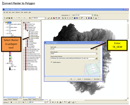
Each of the factors was used in an overlay analysis within GIS to create the resulting USLE values as an erosion distribution map and erosion index map. Below you will find a list of each factor, the exact equations used in calculating the factor value, and the steps taken within GIS to create each factor. Also included below is the first step in the process, delineating the Tekeze River Watershed.
____________________________________________________________________________________
Click on links below to jump to desired GIS analyses steps
Delineation of Tekeze River Watershed
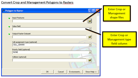
Crop Management Factor (C) and Management Practice Factor (P)
____________________________________________________________________________________
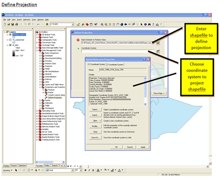
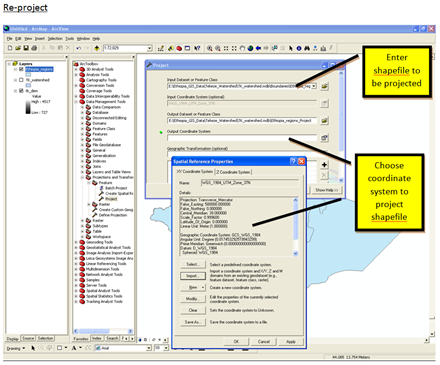
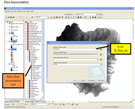
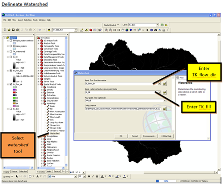
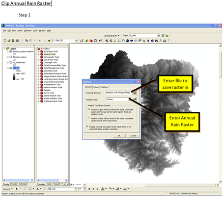
Delineation of the Tekeze River Watershed
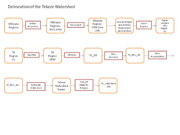
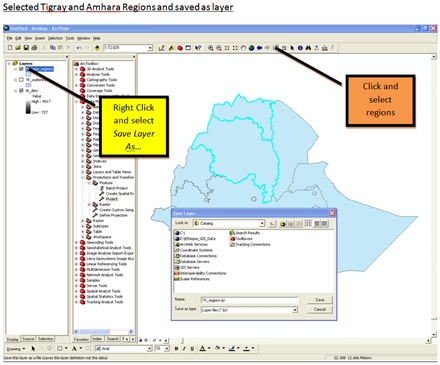
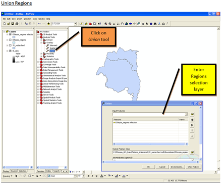
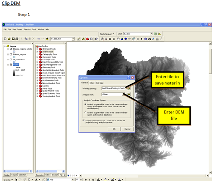
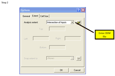
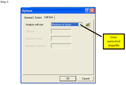
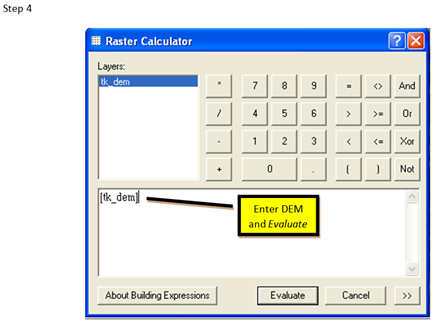
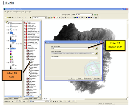
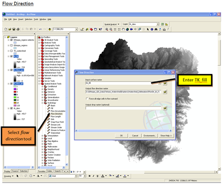
Steps taken in GIS to Delineate Tekeze River Watershed
____________________________________________________________________________________
Slope Steepness Factor, S
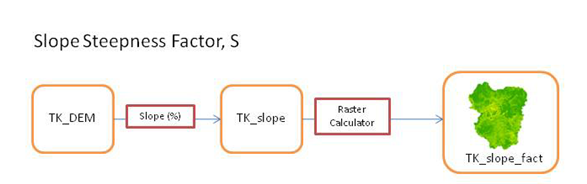
Equation used to Calculate Slope Steepness Factor
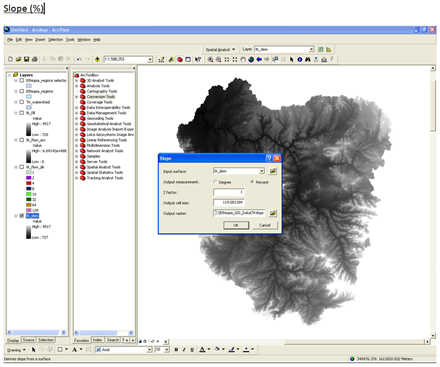
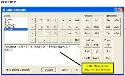
Steps taken in GIS to Calculate Slope Steepness Factor
____________________________________________________________________________________
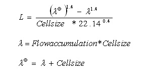
Slope Length Factor, L
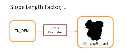
Equation used to Calculate Slope Length Factor
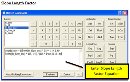
Steps taken in GIS to Calculate Slope Length Factor
____________________________________________________________________________________
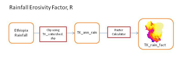
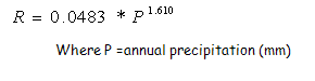
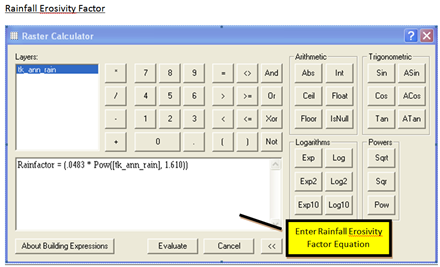
Rainfall Erosivity Factor, L
Equation used to Calculate Rainfall Erosivity Factor
Steps taken in GIS to Calculate Rainfall Erosivity Factor


____________________________________________________________________________________
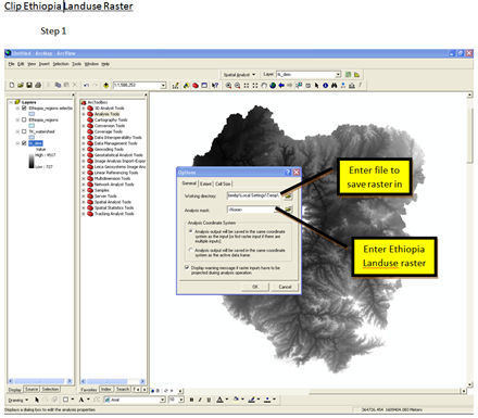
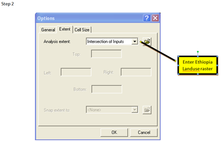
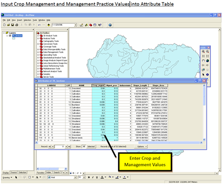
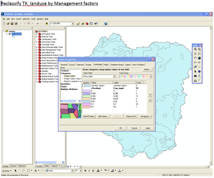
Crop Management Factor (C) and Management Practice Factor, (P)
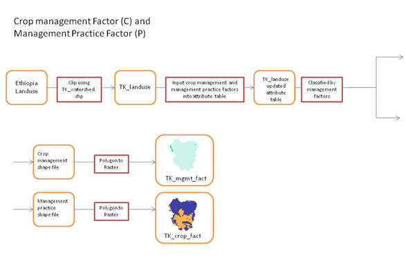
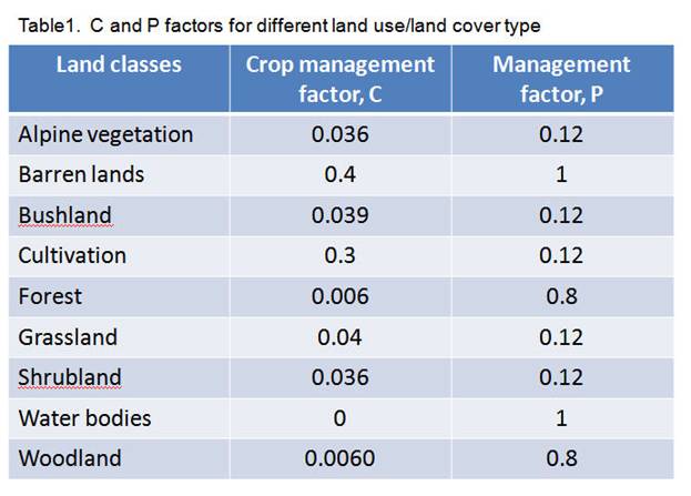
Values used to Calculate Crop Management Factor, and Management Practice Factor
Steps taken in GIS to Calculate Crop Management Factor (C) and Management Practice Factor, (P)

____________________________________________________________________________________
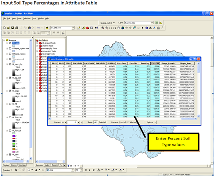
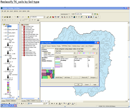
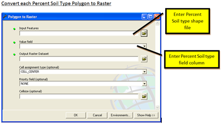
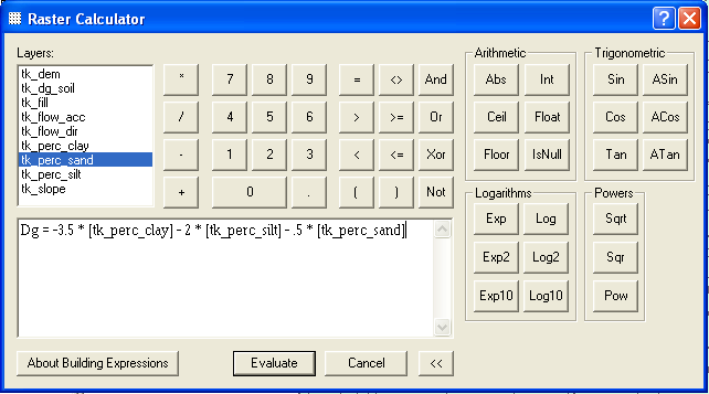
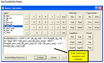
Soil Erodibility Factor, K
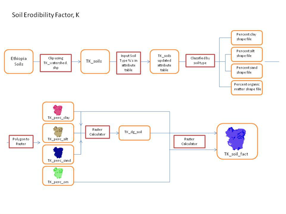
Equation used to CalculateSoil Erodibility Factor, K
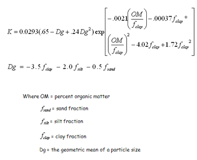
Steps taken in GIS to Calculate Soil Erodibility Factor, K


____________________________________________________________________________________